
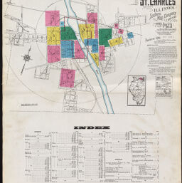
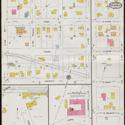
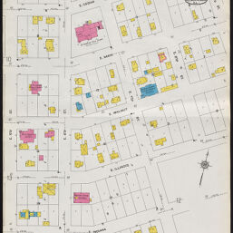
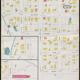
St. Charles, Kane County, Illinois, April 1923. Sanborn Map Company of New York
Permalink
https://digital.library.illinois.edu/items/eda85110-d7d3-0137-6f52-02d0d7bfd6e4-0
In the public domain.
Descriptive Information
| Title | St. Charles, Kane County, Illinois, April 1923. Sanborn Map Company of New York |
| Creator | Sanborn Map Company |
| Coverage-Spatial | Saint Charles (Ill.) |
| Genre | Fire insurance maps |
| Subject | Fire risk assessment |
| Publisher | Sanborn Map & Publishing Co. |
| Date of Publication | 1923 |
| Place of Publication | New York (N.Y.) |
| Scale | Scale ca. 1:600 |
| Language | English |
| Notes |
|
| Extent | 14 maps : color |
| Dimensions | 65 x 55 cm |
| Coordinates | (W 88°18ʹ31ʺ/N 41°54ʹ51ʺ) |
| Rights | No Copyright - United States |
| Rights Description | In the public domain. |
| Type | Cartographic material |
| Repository | Map Library |
| Local Bib ID | 7409623 |
| Collection Title | Sanborn Fire Insurance Maps |
| Collection | Sanborn Fire Insurance Maps |
Download Options
|
Index | |

|
Page 2 | |
|
Page 3 | |

|
Page 4 | |
|
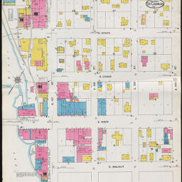
Page 5 | |

|
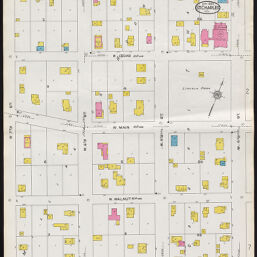
Page 6 | |
|
Page 7 | |

|
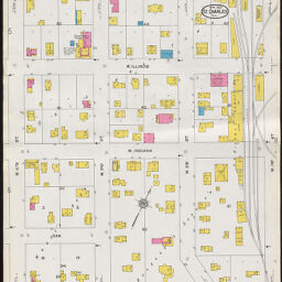
Page 8 | |

|
Page 9 | |
|
Page 10 | |
|
Page 11 | |

|
Page 12 | |
|
Page 13 | |

|
Page 14 |
Contact us
for questions and to provide feedback.