
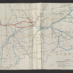
Map of the Michigan Southern and Northern Indiana railroads, with their connections from New York to Council Bluffs
Permalink
https://digital.library.illinois.edu/items/f0f5e980-8a51-013a-c212-02d0d7bfd6e4-7
No Copyright - United States
Descriptive Information
| Title | Map of the Michigan Southern and Northern Indiana railroads, with their connections from New York to Council Bluffs |
| Scale | Scale not given. |
| Place of Publication | New York (N.Y.) |
| Publisher | Leefe, Geo. E. |
| Date of Publication | 1854 |
| Extent | 1 map : hand color |
| Dimensions | 41 x 136 cm |
| Notes |
|
| Coverage-Spatial | United States |
| Language | English |
| Subject | |
| Genre | |
| Rights | No Copyright - United States |
| Type | Cartographic material |
| Repository | Map Library |
| Local Bib ID | 99162187012205899 |
| Collection Title | Railroad Maps |
| Collection | Railroad Maps |
Download Options
|
Map of the Michigan Southern and Northern Indiana railroads, with their connections from New York to Council Bluffs |
Contact us
for questions and to provide feedback.