
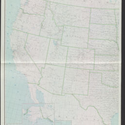
United States
Permalink
https://digital.library.illinois.edu/items/f10397d0-8a51-013a-c212-02d0d7bfd6e4-d
No Copyright - United States
Descriptive Information
| Title | United States |
| Creator | Geological Survey (U.S.) |
| Scale | Scale 1:2,500,000 ; Albers equal area proj. based on standard parallels 29 1/2⁰ and 45 1/2⁰. |
| Coordinates | (W 124⁰45ʹ--W 67⁰00ʹ/N 49⁰--N 25⁰) |
| Place of Publication | Washington (D.C.) |
| Publisher | Geological Survey (U.S.) |
| Date of Publication | 1953 |
| Extent | 1 map on 2 sheets : col. |
| Dimensions | 121 x 196 cm., on sheets 130 x 105 cm. each. |
| Notes | Insets: Alaska -- Hawaii -- Canal Zone -- Puerto Rico and Virgin Islands -- [North Pacific Ocean] |
| Coverage-Spatial | United States |
| Language | English |
| Subject | Railroads |
| Genre | Maps |
| Rights | No Copyright - United States |
| Type | Cartographic material |
| Repository | Map Library |
| Local Bib ID | 99162228312205899 |
| Collection Title | Railroad Maps |
| Collection | Railroad Maps |
Download Options
|
99162228312205899-001 | |

|
99162228312205899-002 |
Contact us
for questions and to provide feedback.