
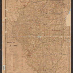
Railroad map of Illinois
Permalink
https://digital.library.illinois.edu/items/f112a220-8a51-013a-c212-02d0d7bfd6e4-2
No Copyright - United States
Descriptive Information
| Title | Railroad map of Illinois |
| Creator | Rand McNally and Company |
| Scale | Scale [1:633,600] 1 in. to 10 miles |
| Coordinates | (W 91°30ʹ--W 87°30ʹ/N 42°30ʹ--N 37°) |
| Place of Publication | Chicago (Ill.) |
| Publisher | Rand McNally and Company |
| Date of Publication | 1910 |
| Extent | 1 map : color |
| Dimensions | 94 x 62 cm |
| Notes |
|
| Coverage-Spatial | Illinois |
| Language | English |
| Subject | Railroads |
| Genre | Thematic maps |
| Rights | No Copyright - United States |
| Type | Cartographic material |
| Repository | Map Library |
| Local Bib ID | 99162323912205899 |
| Collection Title | Railroad Maps |
| Collection | Railroad Maps |
Download Options
|
Railroad map of Illinois |
Contact us
for questions and to provide feedback.