
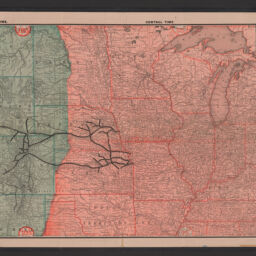
Official map of the Union Pacific Railway : through Kansas & Nebraska and from Colorado, Wyoming, Montana, Utah, Nevada, Idaho, Washington, Oregon & California
Permalink
https://digital.library.illinois.edu/items/f12b87e0-8a51-013a-c212-02d0d7bfd6e4-a
No Copyright - United States
Descriptive Information
| Title | Official map of the Union Pacific Railway : through Kansas & Nebraska and from Colorado, Wyoming, Montana, Utah, Nevada, Idaho, Washington, Oregon & California |
| Alternative Title |
|
| Creator | Rand McNally and Company |
| Scale | Scale not given |
| Place of Publication | Chicago (Ill.) |
| Publisher | Rand McNally and Company |
| Date of Publication | 1886 |
| Extent | 1 map : color |
| Dimensions | 40 x 110 cm |
| Notes |
|
| Coverage-Spatial | United States |
| Language | English |
| Subject | Union Pacific Railroad Company |
| Genre | Thematic maps |
| Rights | No Copyright - United States |
| Type | Cartographic material |
| Repository | Map Library |
| Local Bib ID | 99347648312205899 |
| Collection Title | Railroad Maps |
| Collection | Railroad Maps |
Download Options
|
99347648312205899-001 | |

|
99347648312205899-002 |
Contact us
for questions and to provide feedback.