
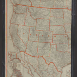
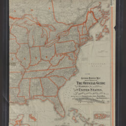
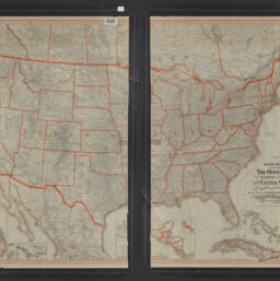
General railway map engraved expressly for the Official guide of the railways and steam navigation lines of the United States, Porto Rico, Canada, Mexico and Cuba, comprising maps of the United States, Cuba, Porto Rico, the Philippines, etc.
Permalink
https://digital.library.illinois.edu/items/f12f4840-8a51-013a-c212-02d0d7bfd6e4-d
No Copyright - United States
Descriptive Information
| Title | General railway map engraved expressly for the Official guide of the railways and steam navigation lines of the United States, Porto Rico, Canada, Mexico and Cuba, comprising maps of the United States, Cuba, Porto Rico, the Philippines, etc. |
| Alternative Title | Folded title: General railroad map |
| Creator | National Railway Publication Company |
| Scale | Scale [ca. 1:3,900,000] |
| Coordinates | (W 129°--W 60°/N 56°--N 21°). |
| Place of Publication | New York (N.Y.) |
| Publisher | National Railway Publication Company |
| Date of Publication | 1918 |
| Extent | 1 map : color |
| Dimensions | 96 x 132 cm |
| Notes |
|
| Coverage-Spatial | Canada |
| Language | English |
| Subject | Railroads |
| Genre | Thematic maps |
| Rights | No Copyright - United States |
| Type | Cartographic material |
| Repository | Map Library |
| Local Bib ID | 99398878012205899 |
| Collection Title | Railroad Maps |
| Collection | Railroad Maps |
Download Options
|
99398878012205899-001 | |
|
99398878012205899-002 | |
|
99398878012205899-003 |
Contact us
for questions and to provide feedback.