
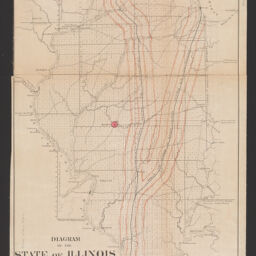
Diagram of the state of Illinois
Permalink
https://digital.library.illinois.edu/items/f160c9a0-8a51-013a-c212-02d0d7bfd6e4-8
No Copyright - United States
Descriptive Information
| Title | Diagram of the state of Illinois |
| Creator | United States. General Land Office |
| Scale | Scale approximately 1:1,114,285 |
| Coordinates | (W 91°30ʹ--W 87°01ʹ/N 42°30ʹ--N 36°58ʹ). |
| Place of Publication | Philadelphia (Pa.) |
| Publisher | Bowen & Co. |
| Date of Publication | |
| Extent | 1 map : hand colored |
| Dimensions | 56 x 38 cm |
| Notes |
|
| Coverage-Spatial | Illinois |
| Language | English |
| Subject | |
| Genre | Maps |
| Rights | No Copyright - United States |
| Type | Cartographic material |
| Repository | Map Library |
| Local Bib ID | 99864364812205899 |
| Collection Title | Railroad Maps |
| Collection | Railroad Maps |
Download Options
|
Diagram of the state of Illinois |
Contact us
for questions and to provide feedback.