
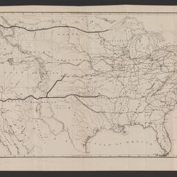
The great railroad routes to the Pacific, and their connections : 1869
Great rail road routes to the Pacific, and their connections, 1869
Permalink
https://digital.library.illinois.edu/items/f18b73d0-8a51-013a-c212-02d0d7bfd6e4-e
No Copyright - United States
Descriptive Information
| Title | The great railroad routes to the Pacific, and their connections : 1869 |
| Alternative Title | Great rail road routes to the Pacific, and their connections, 1869 |
| Creator | Gorlinski, Joseph |
| Scale | Scale approximately 1:7,600,000 |
| Coordinates | (W 124°50ʹ--W 66°53ʹ/N 49°23ʹ--N 24°23ʹ). |
| Place of Publication | New York (N.Y.) |
| Publisher | American Photo-Lithographic Company |
| Date of Publication | 1869 |
| Extent | 1 map |
| Dimensions | 35 x 69 cm, folded to 22 x 11 cm |
| Notes |
|
| Coverage-Spatial | United States |
| Language | English |
| Subject | |
| Genre | Maps |
| Rights | No Copyright - United States |
| Type | Cartographic material |
| Repository | Map Library |
| Local Bib ID | 99954882108705899 |
| Collection Title | Railroad Maps |
| Collection | Railroad Maps |
Download Options
|
The great railroad routes to the Pacific, and their connections : 1869 |
Contact us
for questions and to provide feedback.