


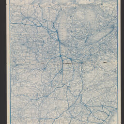
Geographically correct map of the Chicago & Eastern Illinois Railroad : Danville route and its connections
Permalink
https://digital.library.illinois.edu/items/f1b804e0-8a51-013a-c212-02d0d7bfd6e4-5
No Copyright - United States
Descriptive Information
| Title | Geographically correct map of the Chicago & Eastern Illinois Railroad : Danville route and its connections |
| Alternative Title |
|
| Creator | Rand McNally and Company |
| Scale | Scale approximately 1:4,363,000 |
| Place of Publication | Chicago (Ill.) |
| Publisher | Rand McNally and Company |
| Date of Publication | 1885 |
| Extent | 1 map |
| Dimensions | 66 x 34 cm, folded to 18 x 10 cm |
| Notes |
|
| Coverage-Spatial | |
| Language | English |
| Subject | |
| Genre | Maps |
| Rights | No Copyright - United States |
| Type | Cartographic material |
| Repository | Map Library |
| Local Bib ID | 99954928169605899 |
| Collection Title | Railroad Maps |
| Collection | Railroad Maps |
Download Options
|
99954928169605899-001 | |

|
99954928169605899-002 |
Contact us
for questions and to provide feedback.